

Quick answer
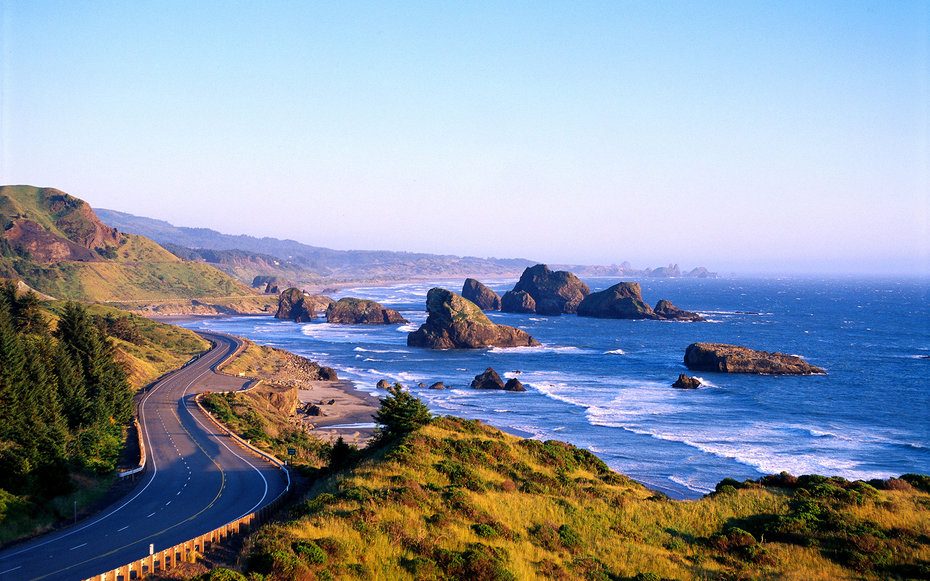
Driving the Oregon Coast from Astoria to Brookings covers 363 miles and takes approximately 7 to 9 hours of continuous driving without stops. Most travelers allocate 3 to 5 days to account for viewpoint stops, coastal town exploration, beach access, and meals. Summer weekends see heavier traffic through Cannon Beach and Lincoln City, adding 30 to 60 minutes to the total transit time.
The Oregon Coast Highway is not measured in hours alone—it is measured in the number of times a driver pulls over. The 363-mile ribbon of US Route 101 threads through every coastal ecosystem the Pacific Northwest offers, from basalt headlands to dune fields to tidepools that reset twice daily. The road itself is engineered for continuity, not speed, with curves that follow the shoreline and elevation changes that require downshifting through forest zones and coastal bluffs. Driving duration along the Oregon coastline depends on intent. A driver moving from Astoria to Brookings without deviation will complete the route in 7 to 9 hours, assuming daylight conditions and moderate traffic. That figure accounts for the posted speed limits, which range from 25 mph through town centers to 55 mph on open stretches, and the physical reality of a two-lane highway shared with recreational vehicles, logging trucks, and seasonal beach traffic. It does not account for the 40-plus state parks, scenic viewpoints, and pullouts that line the route, each representing a decision point. The Oregon Coast road trip becomes a multi-day experience the moment a traveler stops at Ecola State Park, walks the sand at Cannon Beach, or detours to Cape Perpetua. The highway operates as a public thoroughfare 24 hours a day, 365 days a year, with no tolls or entry fees. Seasonal variables matter. Winter storms reduce visibility and create standing water on low-lying sections near Tillamook and Florence. Summer traffic concentrates in the northern and central zones, particularly between Cannon Beach and Newport, where beach town congestion can add an hour to the drive. Fall and spring offer clearer roads and dramatic light, with fog banks that shift throughout the day. Fuel stations and services cluster in larger towns—Astoria, Seaside, Tillamook, Newport, Florence, Coos Bay, Bandon, and Brookings—with gaps of 30 to 50 miles in between. The Oregon Coast driving time calculation begins with the 363-mile baseline and expands based on the number of stops a traveler chooses to make. Shore Acres State Park, the Sea Lion Caves, and the overlooks at Cape Kiwanda each require 30 minutes to an hour. A meal stop in a coastal town adds another hour. Tidepool exploration at low tide can consume an entire afternoon. The highway's design assumes that drivers will stop, which is why the state has formalized more than 80 pullouts and viewpoints along the route. The question is not whether to stop, but how many times, and for how long.
“The Oregon Coast Highway is not measured in hours alone—it is measured in the number of times a driver pulls over.”
How Long Does It Take to Drive the Oregon Coast: Realistic Timeframes
This itinerary suits travelers with 3-5 days to explore the coast at a comfortable pace, balancing driving with stops at key viewpoints and coastal towns. Pure driving time from Astoria to Brookings is 8-10 hours, but meaningful exploration requires multiple days.
Astoria to Cannon Beach
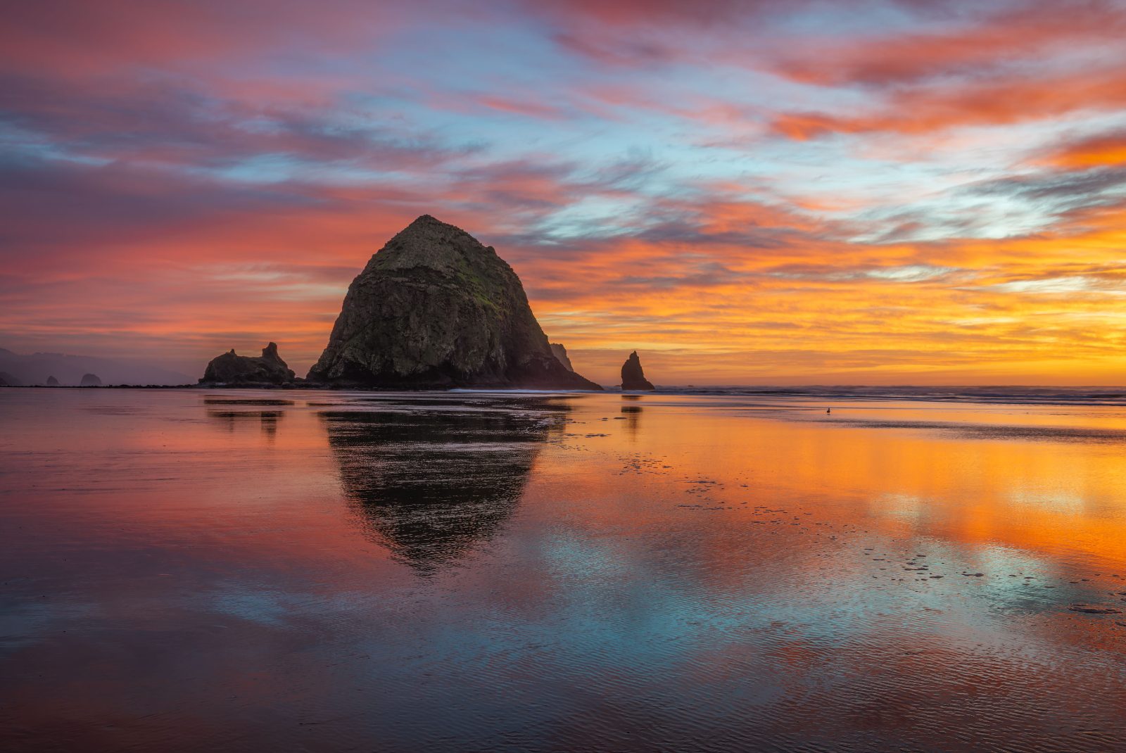
Start at the Columbia River mouth in Astoria, then drive south to Cannon Beach to see Haystack Rock. Budget 2-3 hours including stops at overlooks. Settle in for the night along this northern stretch.
Tillamook to Newport
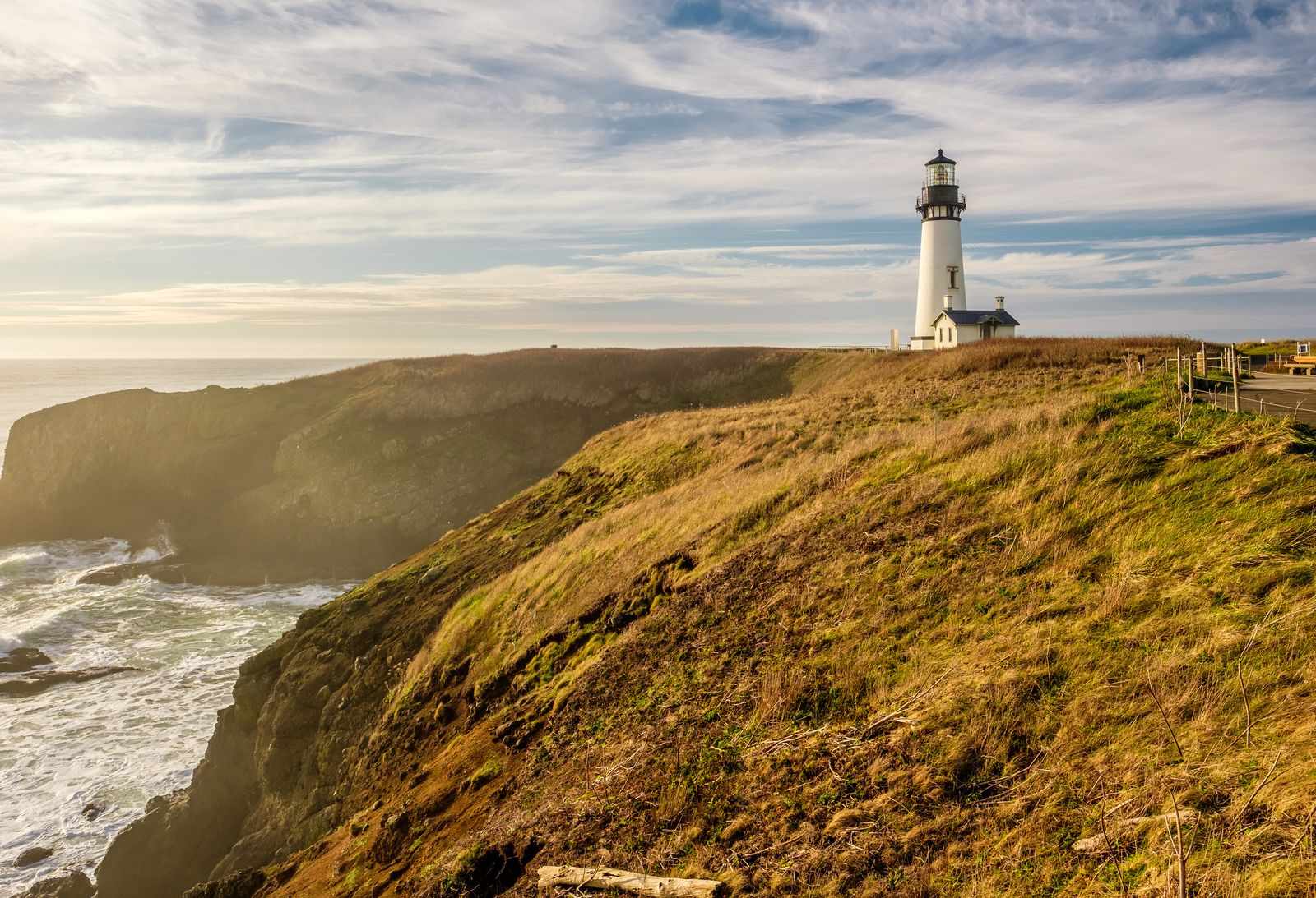
Continue through Tillamook's dairy country and Cape Lookout, then reach Newport by afternoon. Explore the historic bayfront and Yaquina Head Lighthouse. Plan 4-5 hours of driving with coastal detours.
Heceta Head to Florence
Stop at Heceta Head Lighthouse and the Sea Lion Caves before reaching Florence and the Oregon Dunes. This segment covers roughly 50 miles and takes 2-3 hours with sightseeing breaks.
Bandon to Gold Beach
Drive the southern coast through Bandon's dramatic rock formations and on to Gold Beach. Allocate 3-4 hours for the 80-mile stretch, with time for beach access points and the Prehistoric Gardens.
Samuel H. Boardman to Brookings
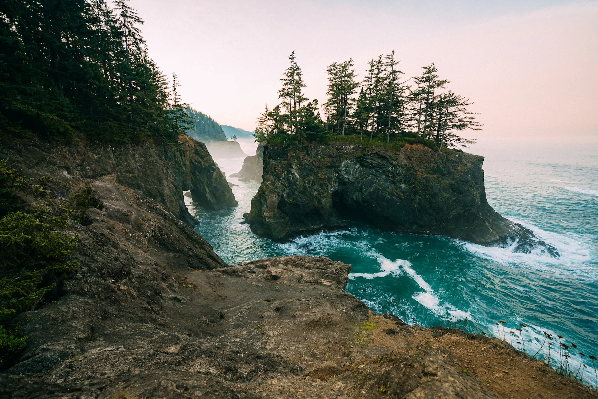
Finish at Samuel H. Boardman Scenic Corridor, where short trails lead to clifftop views and natural bridges. This final 30-mile segment takes 1-2 hours, wrapping up your full-coast journey.
Planning When to Drive the Oregon Coast for Optimal Conditions
The period from late spring through early autumn offers the most reliable daylight for viewing the coastline. Choosing these months balances the need for visibility against the region's frequent coastal fog and winter rain patterns.
Late Spring and Early Fall
ModerateClearer skies, 55°F–65°F
These shoulder months provide a balance of mild weather and reduced traffic. You will find higher visibility for coastal scenery during these times.
Summer Months
HighWarm, 60°F–70°F
Expect consistent daylight hours but higher volume on the roads. Morning fog is common but typically clears by midday.
Winter Months
LowRainy and windy, 40°F–50°F
Storm watching is popular, though daylight hours are significantly shorter. Road conditions require extra caution due to frequent precipitation.
Weekday Mornings
Low—
Starting early on a weekday minimizes encounters with local commuters and weekend visitors. This timing provides the most consistent access to parking areas.
Verdict: The most favorable conditions occur on weekday mornings during September or May, when traffic is lighter and coastal fog is less likely to obscure visibility.
How to Get to the Route When Deciding How Long It Takes to Drive the Oregon Coast
The Oregon Coast is accessible from the Willamette Valley via several primary highways that connect to the north-south artery of US Highway 101. Travelers departing from Portland typically utilize OR-6 or OR-18 to reach the coast efficiently.
US Highway 101
OR-6 W to Tillamook
OR-18 W to Lincoln City
Key Stops to Consider When Planning How Long It Takes to Drive the Oregon Coast
The Oregon Coast offers diverse coastal geography, ranging from iconic rock formations to expansive state parks. Planning your drive requires selecting specific stops along US Highway 101 to balance travel time with exploration.
Cannon Beach
Home to Haystack Rock, this location features expansive sandy shores and accessible tide pools. Visit during low tide to observe marine life at the base of the rock.
Check tide charts before visiting to safely access the rock.
Newport
This coastal city hosts the Oregon Coast Aquarium and the historic Yaquina Head Lighthouse. The area provides access to diverse marine environments and harbor views.
Walk the Yaquina Head tide pools during low tide.
Samuel H. Boardman State Scenic Corridor
This stretch of coastline contains dramatic cliffs, natural arches, and hidden coves. It is situated in the southern portion of the state and offers numerous pull-offs for observation.
Park at the Arch Rock viewpoint for coastal vistas.
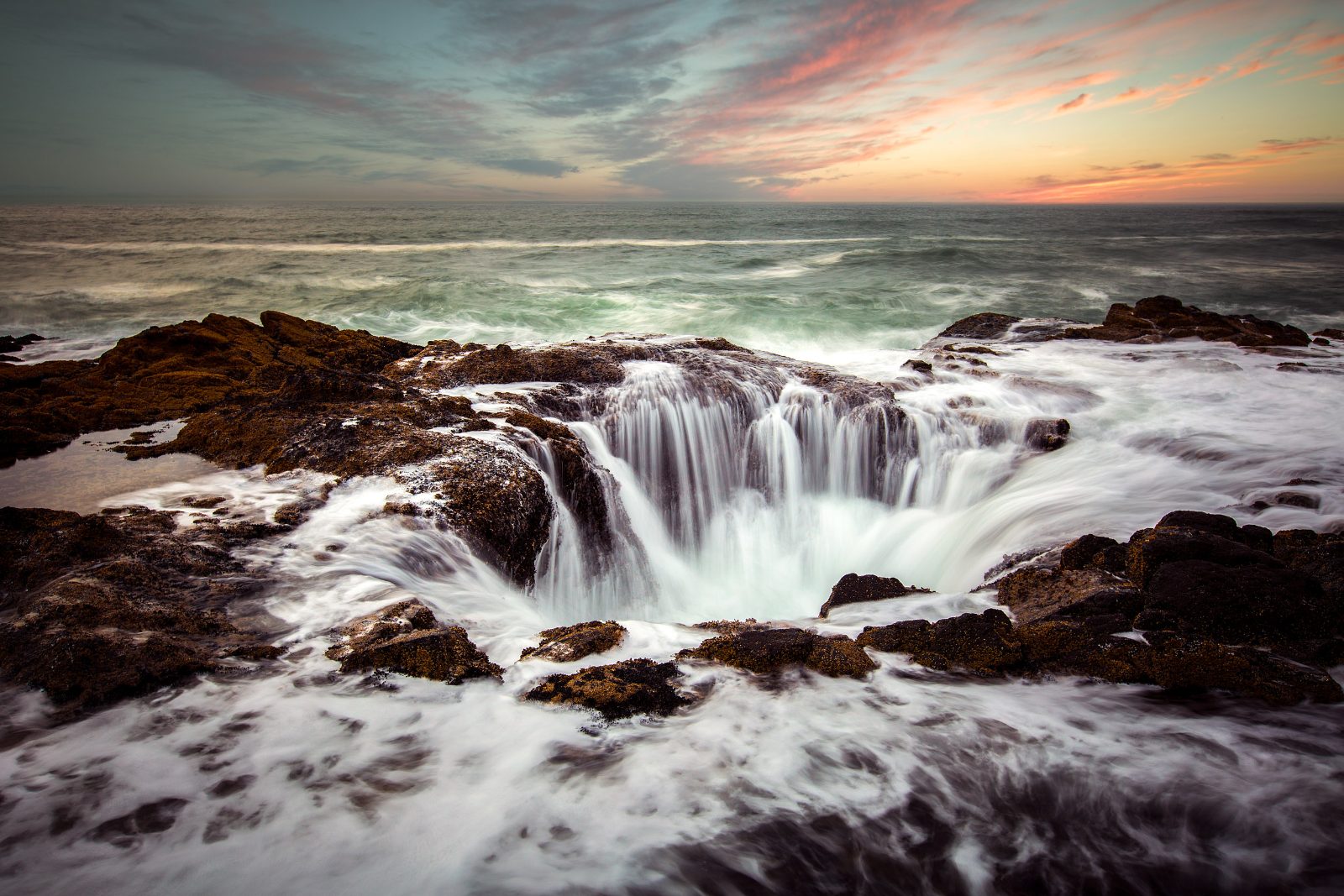
Cape Perpetua Scenic Area
Known for the Thor’s Well sinkhole and the Spouting Horn, this area demonstrates the power of Pacific waves against basalt rock. Trails lead visitors through old-growth forests to high vantage points.
View Thor's Well one hour before high tide.
Operating Hours for How Long It Takes to Drive the Oregon Coast
US Highway 101 is a public road accessible 24 hours a day, seven days a week. While the route remains open at all times, daylight is recommended to navigate the road and view the coastal landscape.
| monday | 00:00–23:59 | |
|---|---|---|
| tuesday | 00:00–23:59 | |
| wednesday | 00:00–23:59 | |
| thursday | 00:00–23:59 | |
| friday | 00:00–23:59 | |
| saturday | 00:00–23:59 | |
| sunday | 00:00–23:59 |
Check availability
Frequently Asked Questions About Driving the Oregon Coast
Everything you need to know about how long does it take to drive the oregon coast